WMS Tile
This UDF fetches WMS tiles from Terrestris OpenStreetMap WMS, using the OSM-WMS layer, which provides standard OpenStreetMap imagery. This function requests tiles based on bounding box coordinates bounds, coordinate reference system CRS, and image size 256x256 pixels. The result is a NumPy array that can be displayed as an image on the tiles.
@fused.udf
def udf(
    bounds: fused.types.Bounds = None,
    wms_url: str = "https://ows.terrestris.de/osm/service",
    layer: str = "OSM-WMS",
    width: int = 256,
    height: int = 256
):
    import numpy as np
    import utils
    from utils import fetch_wms


    z = utils.common.estimate_zoom(bounds)
    print(f"Estimated zoom level: {z}")

    if z < 4:
        print("WARNING: Please zoom in more for better visualization. Zoom level should be at least 4.")

        return np.zeros((4, height, width), dtype=np.uint8)

    data = fetch_wms(
        wms_url=wms_url,
        layer=layer,
        bbox_coords=bounds,
        width=width,
        height=height
    )

    return data
The fetch_wms Utils function looks like this.
common = fused.load("https://github.com/fusedio/udfs/blob/main/public/common/utils.py").utils

def fetch_wms(
    wms_url: str,
    layer: str,
    bbox_coords: tuple,
    width: int,
    height: int,
    version: str = "1.3.0",
    format: str = "image/png",
    crs: str = "EPSG:4326",
    transparent: bool = True
):
    import requests
    from io import BytesIO
    from PIL import Image
    import numpy as np
    try:
        minx, miny, maxx, maxy = bbox_coords

        # Handle bbox order based on WMS version and CRS
        if version == "1.3.0" and crs.upper() in ["EPSG:4326", "CRS:84"]:

            bbox_str = f"{miny},{minx},{maxy},{maxx}"
        else:

            bbox_str = f"{minx},{miny},{maxx},{maxy}"

        # Construct WMS parameters
        params = {
            'SERVICE': 'WMS',
            'VERSION': version,
            'REQUEST': 'GetMap',
            'LAYERS': layer,
            'STYLES': '',
            'CRS' if version == "1.3.0" else 'SRS': crs,
            'BBOX': bbox_str,
            'WIDTH': width,
            'HEIGHT': height,
            'FORMAT': format,
            'TRANSPARENT': 'TRUE' if transparent else 'FALSE'
        }

        response = requests.get(wms_url, params=params)

        if response.status_code != 200:
            print(f"Error: HTTP status {response.status_code}")

        # Check content type
        content_type = response.headers.get('Content-Type', '')

        # Process image response
        if 'image' in content_type.lower() or response.content[:4] in [b'\xff\xd8\xff\xe0', b'\x89PNG']:
            img = Image.open(BytesIO(response.content))
            array = np.array(img)

            # Convert to channels-first format
            if len(array.shape) == 3:  # RGB or RGBA
                array = array.transpose(2, 0, 1)
            else:  # Grayscale
                array = array[np.newaxis, :, :]

            return array
        else:
            print(f"Error: Response not an image. Content type: {content_type}")


    except Exception as e:
        print(f"Error fetching WMS: {e}")
WMS Examples to try out in the UDF
The wms_url and layer parameters can be set to any WMS service and layer you want to visualize. Here are some examples to get you started:
- wms_url (str): The base URL of the WMS service
- layer (str): The layer name to request
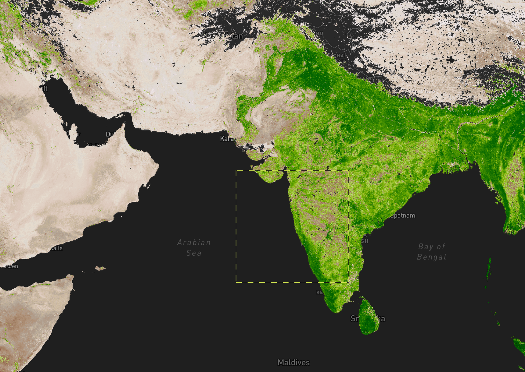
1. NASA GIBS (Global Imagery)
URL: https://gibs.earthdata.nasa.gov/wms/epsg4326/best/wms.cgi
Layers:
MODIS_Terra_CorrectedReflectance_TrueColor- Satellite imageryMODIS_Terra_Snow_Cover- Snow cover dataMODIS_Terra_NDVI_8Day- Vegetation index
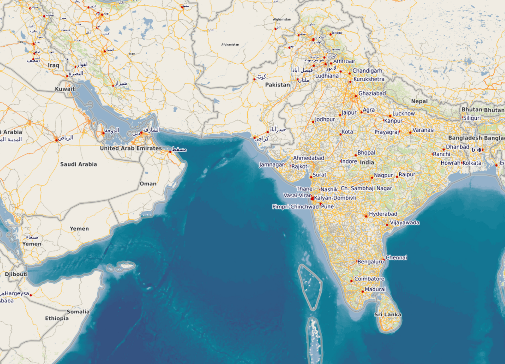
2. OpenStreetMap
URL: https://ows.terrestris.de/osm/service
Layers:
OSM-WMS- OpenStreetMap base mapTOPO-WMS- Topographic view
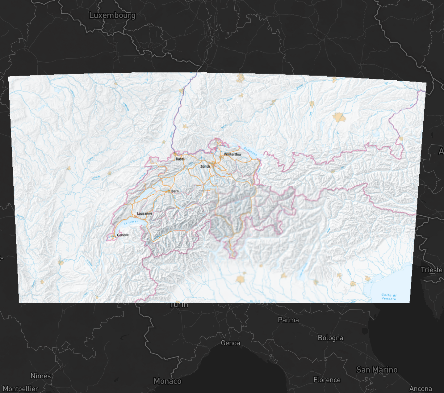
3. Swiss Federal Geoportal
URL: https://wms.geo.admin.ch/
Layers:
ch.swisstopo.pixelkarte-farbe- Swiss national mapch.swisstopo.swissimage- Aerial imagery