Fused redefines geospatial with instant maps


Fused is a modern geospatial toolkit for companies to code, scale, and ship geospatial workflows of any size.
This week we are unveiling Fused, a toolkit to enable interoperability between all geospatial datasets and tools in the modern data stack. Fused is the glue layer that integrates data platforms with data tools via a managed serverless API.
Overview
Co-founders Sina Kashuk and Isaac Brodsky met while working at Uber. They co-founded Unfolded to commercialize the popular open source geospatial visualization projects Kepler.gl, Deck.gl, and H3. Unfolded was acquired by Foursquare in June, 2021.
Fused has raised $1 million in pre-seed funding from Fontinalis Partners, Wes McKinney, Michael Driscoll, Jason Richman, and angels from Uber, Airbnb, DoorDash, and others.
Fused delivers serverless geospatial operations at any point of the stack — with a simple HTTPS call. This is like when users pull-up information from map apps, but with custom and transparent logic. This shields developers from hours of burdensome engineering, enabling businesses to serve their customers with timely insights, faster.
Teams supercharge their favorite IDEs, tools, and frameworks with Fused. They build with the Python SDK, preview on the browser with Fused Workbench, and run in their stack via the Hosted API.
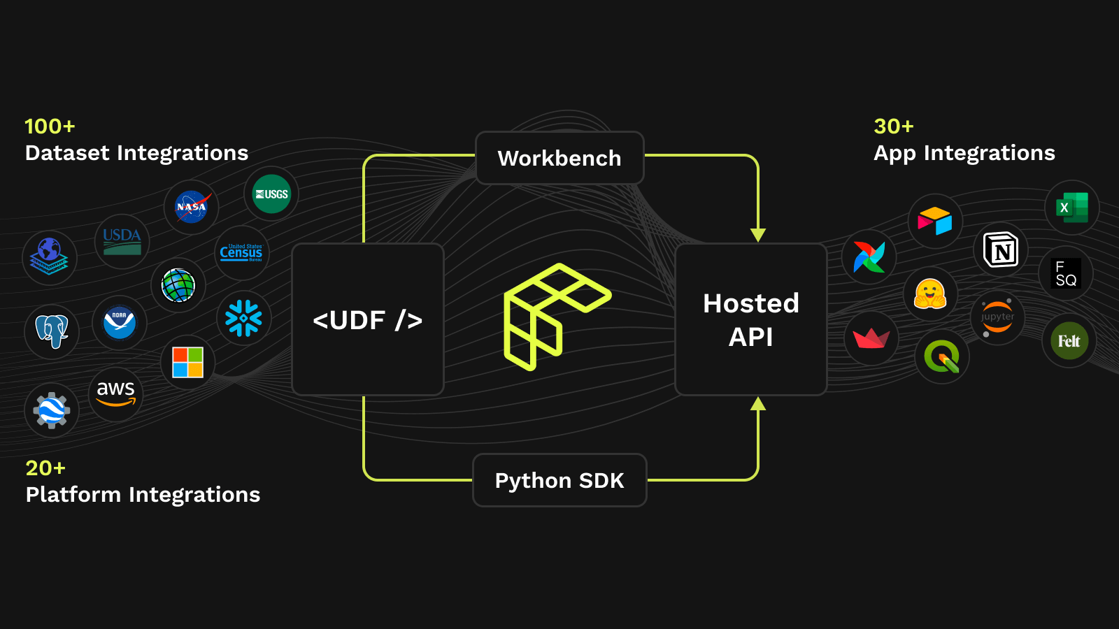
Fused ecosystem and product line.
The problem
We're now in a moment where large-scale geospatial datasets are migrating to open cloud-enabled formats. However, we have personally seen how it can be challenging to utilize this data at scale. At the same time, there has been a rise in Earth observation imagery, which will only accelerate as we monitor climate change and as satellites continue scaling, enabling. However, the sheer volume of data, complexity of operations, and fragmentation of tooling holds back how we process and present that data that is critical for making informed decisions about critical company operations.
Today, data scientists and analysts manually conduct multistep processes fragmented across tools and data standards with the help of an army of data engineers and infra (if they are lucky) just to render data on a map. The size of data limits the possible depth of insight of last-mile analytics and the speed at which they can be delivered — leaving problems unaddressed. Moreover, data scientists handoff algorithms to data engineers who then translate code to work with orchestrators that run on distributed compute systems maintained by an entire devops team. An analyst needs to navigate a sea of buzzwords like CRS, GDAL, Spark clusters, geo-partitions, raster and vector joins, zonal stats, and census blocks — just to prepare for the analysis they actually want to do.
The solution
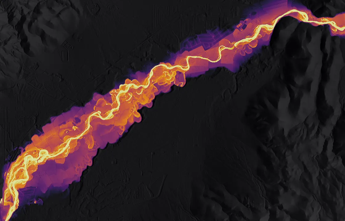
Today, a leading global media company animates atmospheric rivers to report weather news — 36x speed improvement, from hours to minutes. An EV company uses Fused to optimize its EV charging station network planning capabilities — blending data at an unprecedented coverage and detail. A carbon offset company creates custom deforestation basemaps with better operational efficiency — closing the analysis loop for stakeholder reports.
Fused empowers teams in these companies to seamlessly layer weather, infrastructure, road, and deforestation data; while transforming it with custom Python code to create apps for real-time decision making. Fused simplifies workflows so small teams can deliver novel business-critical insights where it wasn't possible before.
Read more: Founder's Blog Post
Vibrant community
As a founding tenet, Fused promotes open source, transparency, and collaboration. To this end, data scientists and app builders engage the Fused community on GitHub and Discord to find, reuse, and share verified code snippets that they can bring into their workflows.
Community UDF of hydrology model by Taher Chegini In sum, Fused allows people for the first time to easily work with geospatial data and integrate it with modern data tools. This is a radical departure from times when for any geospatial analysis you would have to send it to your GIS person to analyze it and get it back in 3 weeks, if you get lucky (and forget about integrating that with any other tools). Fused is built to be the interoperable glue between geospatial data systems, and we're excited to bring best-in-class cloud infrastructure and distributed computing to this industry.
Join the journey to break away from old geospatial infrastructure. Let's revolutionize geospatial technology together! fused.io. 🌎🚀
Join the journey