The App That Finds Your City's Rainfall Twin Globally
· 3 min read

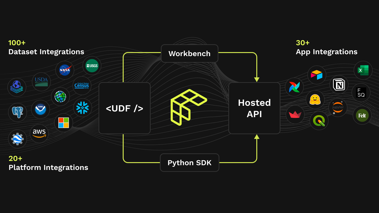
TL;DR Milind analyzes global precipitation patterns using H3 indexing, cosine similarity, and Earth Engine data to create an interactive rainfall comparison app.
This article explores a User Defined Function (UDF) that utilizes global precipitation data to compare rainfall patterns between different locations worldwide and then creates an interactive app!