Hot-spot analysis for invasive species using Overture Maps

TL;DR Elizabeth Rosenbloom creates hotspot maps to identify key areas where Arundo donax is likely to spread, streamlining analysis to improve invasive species mitigation.
In 2020 while working in Silicon Valley for the county of Santa Clara Valley, I became obsessed with improving monitoring and prevention efforts surrounding Arundo donax. The search and mitigation process this invasive plant species, Arundo donax, was a Sisophisian struggle that had been subject to the same procedures year in and year out, with no progress on beating the spread. To improve the efficacy and efficiency in battling against this notorious weed, I decided to build a tool that would identify the key areas for mitigation - both for the frequency of propagation (occurrence) and for spread potential.
In this blog post I show how I used Fused to create a map of key hotspots where Arundo donax is likely to spread based on built-environment factors derived from Overture Maps data.
To follow along, you check out the UDF associated with the blog post:
Introduction
In 2020, the problem with managing Arundo was that many agency employees considered this to be a hopeless pursuit, given the exorbitant amount of time cleaning, layering, and calculating the weighted analysis would take. Despite our vast ArcGIS library of tools, engineers, hydrologists, and GIS managers all warned me that I was going to drive myself crazy trying to get the enterprise software to successfully run my analysis. My only regret in building the tool back then was that I didn't have a tool like Fused to expedite the data pulling, processing, and calculating - as it would have saved me from the very lunacy I was warned about.
The obsession with the grass species, Arundo donax, began with an insight to the positive feedback loops created by increased flooding and the spread of invasive species due to climate change. Arundo donax is one of the most invasive plant species worldwide. In addition to destroying biodiversity and disrupting habitats for native species, this large grass also contributes to significant flooding patterns. As weather events become more severe and biodiversity declines, these changes create compounded consequences in our changing climate.
Challenges with Hot-spot Analysis
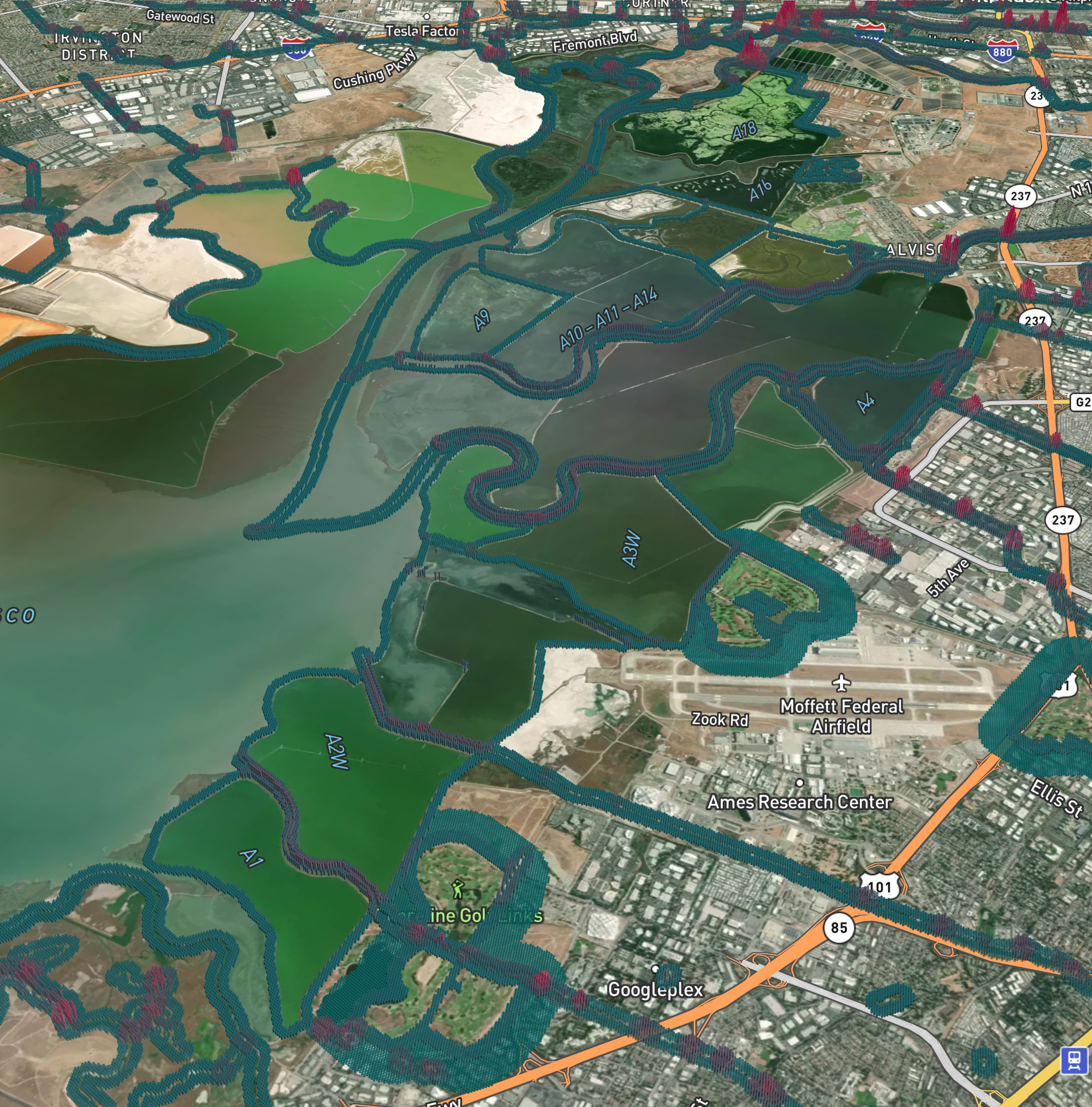
Hot-spot analysis tools using weighted sums can significantly increase accuracy in targeting key areas for prevention. To build a hot-spot analysis for Arundo donax, the following variables need to be scored according to their degree of influence: distance to nutrient loading sources (such as a golf course), distance to a riparian buffer (creek or river), distance to a water-flow disruptor (such as a bridge), and size of the stream.
The key pain points of running a weighted sum on traditional GIS software include:
- Slow calculations: "State-of-the-art" software like ArcGIS can take several hours to calculate weighted sums. Furthermore, running weighted sums on large datasets/geographic areas can be nearly impossible given exhaustive RAM and GPU demands, so analyses over 1000 sq miles often require a user to split analyses into different geographic regions.
- Program crashes: beyond the significant wait time required for typical weighted sum calculations, users of prominent GIS software often experience output delays as a result of runtime errors and other issues spurring a program crash.
- Data transformations, cleaning, and standardization: most users of traditional GIS software will find they need to start from scratch when compiling data for a hot-spot analysis or weighted sum. Sometimes, standard base layers like slope and aspect will be searchable on the local software basis. Still, often, lengthy transformations are required to make the layers compatible with the final overlay calculation.
How Fused Changed My Workflow
Using cloud-based systems like Fused can significantly increase calculation speeds, program resilience, and access to public Cloud Native datasets.
After encountering the Fused and learning about how I could improve the speed and geographic spread of site suitability analyses, I wanted to put it to the test by expanding on a previous analysis I did in 2021 using ArcGIS. The original 2021 analysis took several months of data collection, interviews with other local agencies, and extensive data cleaning, standardization, and transformations. I experienced all the aforementioned pain points of hot-spot analysis/weighted sum calculations and more.
Flash forward to today, where I am compiling global data sets, layering them, and deriving statistical insights within 1% of the time that it took me using ArcGIS. Running buffer analyses, weighting variables, and procuring data has taken a fraction of the time for GLOBAL data - and if you remember from before, the previous analysis from 2021 took months for a county-wide calculation and final product.
The most satisfying aspect of my new hot-spot analysis application wasn't just the expansive end product; the process was more seamless and engaging than I had imagined.
Workflow Design
I created a UDF with a simple model to identify hotspots susceptible to arundo. The model uses a weighted sum of several base Overture data classes:
- Golf Courses
- Bridges
- Water bodies (rivers, streams, etc.)
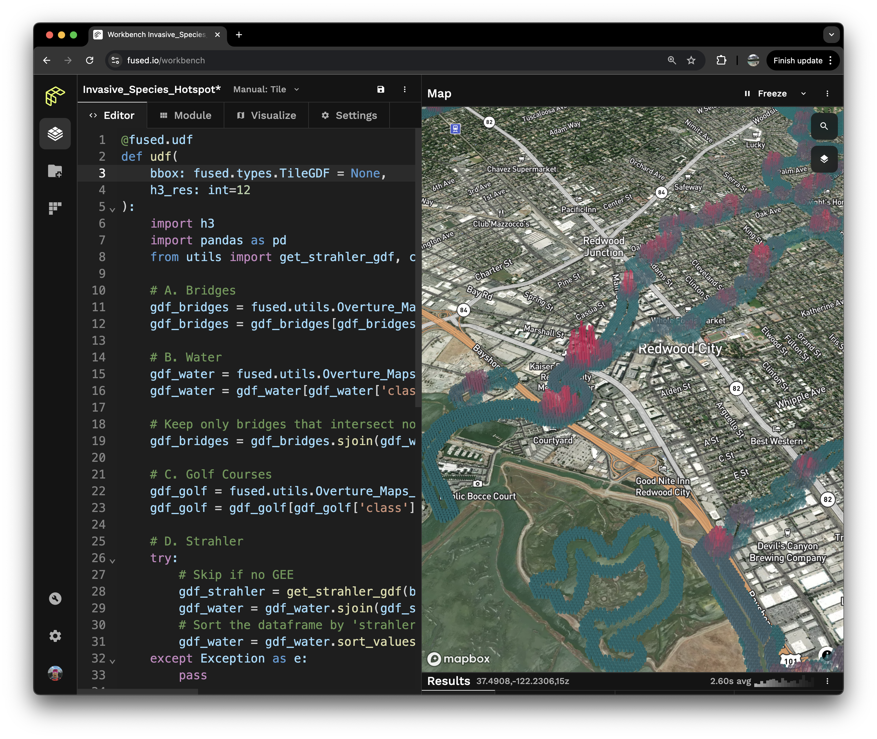
The UDF performs the following steps:
- Create GeoDataFrames from the Overture maps dataset using get_overture
- Generate an H3 score based on buffers around each feature
- Aggregate the H3 scores to create a weighted sum
Key Takeaways
Given the complexity of procuring, layering, and interweaving data along with significant wait times and resource consumption, many governmental agencies, non-profits, and even private corporations struggle to run spatial analyses such as site-suitability and hot-spot tools. Insights and tools can be created by improving the speed and efficacy of operations such as weighted sums and fuzzy analysis across spatial layers with UDFs.
Site-suitability and hot-spot analysis go beyond species detection. By simplifying the approach to these types of tools, we can more quickly and accurately detect climate-vulnerable zones, prioritize habitat restoration, and create models to build resilient communities. Industries such as real estate development, retail, and logistics can more quickly understand the variables that affect their businesses by using cloud-based systems like Fused, which can easily manage large datasets.