Building Geospatial Real-Time Analysis in Fused

Chris Kyed, Data Scientist at Pacific Spatial Solutions, showcases 3 real time geospatial analysis uses cases for Fused.
Last year Chris showcased how Pacific Spatial uses Fused to analyze 100 Billion drive records. Pacific Spatial Solutions is a company that provides geospatial analysis & data science services for various industries in Japan.
Ocean Health Mapping
River plumes carry nutrients/sediment to the ocean and are split in 2 broad categories:
- Good plume: natural sediment/nutrient redistribute & add biodiversity
- Bad plume: excessive sediment/waste water and toxins/agricultural fertilizer with negative biodiversity impacts
Mapping them can be helpful for understanding the health and human activities impact on the ocean.
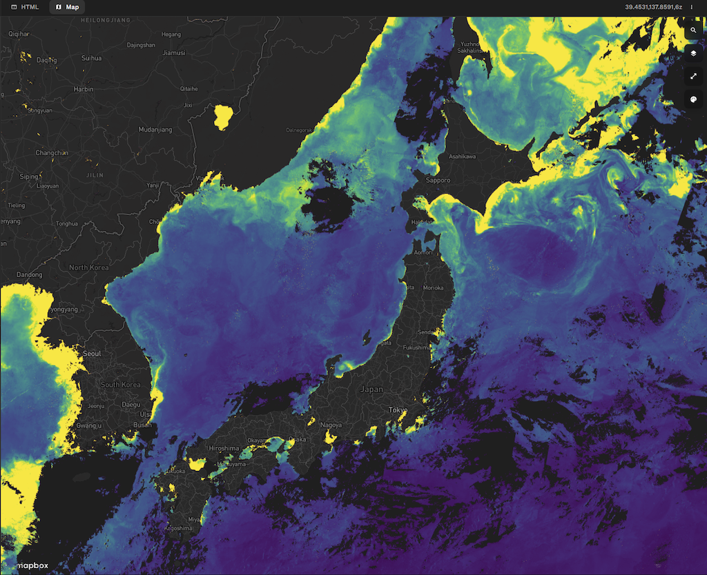
These datasets are open and available through the Jaxa Earth API :
- Chlorophyll-a concentration (Daytime/Half-monthly)
- Sea surface temperature (Daytime/Half-monthly)
- Precipitation Rate (Half-monthly)
Rainfall & Incidence Data
Traffic accidents and traffic safety has been one of the most important problems for the last many decades. Now that we have publicly accessible data regarding the accidents, we need to find ways to access and analyze it.
The Japanese National Police Agency published yearly traffic incidence data all around the country.
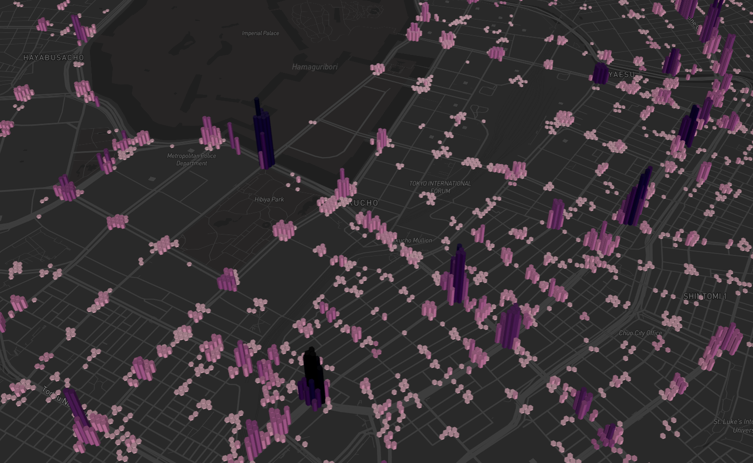
Explore the code directly in Fused:
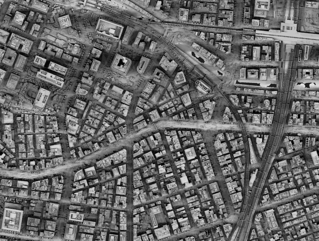
Tokyo Shadow Map
Japanese summers can get very hot, which is amplified in large urban areas creating urban heat islands.
Prolonged exposure to the sun can cause dehydration and sunstroke, so we want to give Tokyo residents and tourists an app that can help them navigate the city in a more comfortable way.
Pacific Spatial Solutions is creating shadow maps for the city of Tokyo by combining 121 point clouds in batch and transforming them into 0.5m resolution DSM data and dynamically rendering them in Fused:
Learn more about Fused
- Try out Fused for yourself for free!
- Dive deeper in the Geospatial with Fused tutorials
- Learn more about working with H3 Tiles